- Année : 2017
- Auteur(s) : ALOUI K.
- Référence : T. XXXVIII, n°3, 2017, pp. 383-386.
- Mots-clés : TELEDETECTION, BASES DE DONNEES, BASSIN MEDITERRANEEN, SYSTEME D’INFORMATION GEOGRAPHIQUE (S.I.G.)
Article en accès libre et téléchargement gratuit
Résumé
Collect Earth is a free, open-access “Open Foris” tool. It enables data to be gathered from images from Google Earth and Google Earth Engine with no need to download satellite images or conduct field visits. Data collection is based on a systematic sampling in which each plot covers 0.5 ha in reference to the FAO’s minimum area for a forest used in its Assessment of Global Forestry Resources. An analysis of the collected data enables an idea to be obtained about the utilisation of the land and changes in use over a given period of time. Tunisia has used this tool for assessing land use and changes to it in the arid regions of North Africa, sampling 15,077 plots during the period 2001-2015, and, in Tunisia,15,850 plots in the period 2000-2016.
Téléchargement de l'article
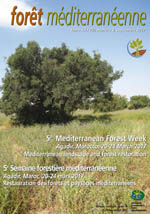
Spécial numéro international "5e Semaine forestière méditerranéenne - Agadir" - T. XXXVIII, n°3, 2017
S'abonner, adhérer, nous soutenir
Je m'abonne pour recevoir les publications de l'association, j’adhère à l’association
en payant ma cotisation et je soutiens l’association en faisant un don.
